Juan P. Aristizabal
B.S. Civil / Geospatial Engineering
California State Polytechnic University, Pomona
CA Engineer In Training # 123244
CA Land Surveyor In Training # 7127
Notable experience obtained working under
registered Civil Engineers and Land Surveyors in the private sector:
CSUSB Observatory:
Provided access road horizontal and vertical alignment design, grading,
volumes and surface modeling.
Needles Hwy, San Bernardino
Co:
Assisted with realignment of about 2.5 mi. of highway in order to
miss ancient indigenous burial sites.
TM 16767, TM 17243 Hesperia,
CA:
Assisted with lot layout design for these two residential tract development,
preparation tract maps, rough grading, street layout and some utilities
design.
Tippecanoe Ave. Street Improvements,
City of San Bernardino, CA:
Assisted with street improvement plans for about 2 mi. of street,
volumes and cut and fill maps.
Morongo Band of Mission Administration
Complex :
Provided rough grading design, surface modeling, rendering, and earthwork
calculations.
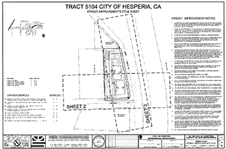
Tract 5104 Hesperia, CA:
Provided street improvement plans, which include quantities, cross
sections, and details.
PME Engineering CAD Standards:
Provided PME with complete set of layer standards, custom AutoCad
toolbars, palettes, linetypes, plot tables, blocks and standard CAD
procedures.
Software Capabilites:
- AutoCad
- AutoCad Map
- Land Development Desktop
- Civil 3D
- Microstation
- Inroads
- Architectural Desktop